A new age for cadastral surveying
Collaboration with OPENGIS.ch
Developing an application for cadastral surveying that is available for users all over Switzerland, based on an open source geoinformation system - this is the aim of an association of Swiss engineering surveyors.
Thinking about this new application from a user’s perspective right from the start - is the aim of OPENGIS.ch and go digital.
Challenge
The new application should be able to fulfill the requirements and processes of the (future) cadastral survey. With the introduction of a new data model in Switzerland “DM.flex”, a change from a static to a modular data model of official cadastral surveying is taking place.
With the development of the application, the industry would like to respond to this significant change. Our joint challenge is to derive a specification out of manifold perspectives,needs and requirements that build the base for an RFP.
Process
First thing: providing structure and a clear approach on how to cluster all the manifold requirements. Within our project we will define all the relevant steps for the target picture. This will build the basis for the RfP. Based on this, offers are solicited and the requirements are detailed and prioritized at a later date.
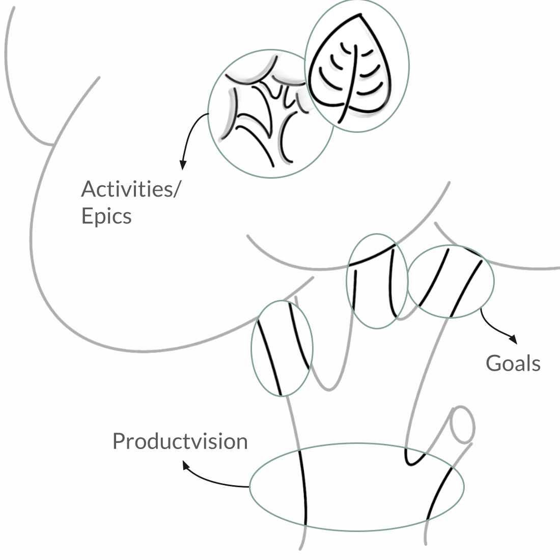
To gather all requirements we used a structure that resembles a tree:
The trunk being the product vision.
The large branches are goals.
The smaller ones are activities (or epics).
The leaves are the tasks (or user stories).
User Stories build the basis for the RFP and later prioritization.

Project approach

Persona overview

Persona template

From product vision to user stories and tasks
Result
In several workshops - online and offline - we broke down the product vision into goals, epics, activities and requirements. We use a top-down approach to split all requirements into actionable steps and implementable tasks.


